Mapping Network Packet Sequences Against Terrain Elevation Data to Forecast Desync Events in Shared-World Traversal Sessions
Erik Perry · Aug 16, 2026
Mapping Network Packet Sequences Against Terrain Elevation Data to Forecast Desync Events in Shared-World Traversal Sessions
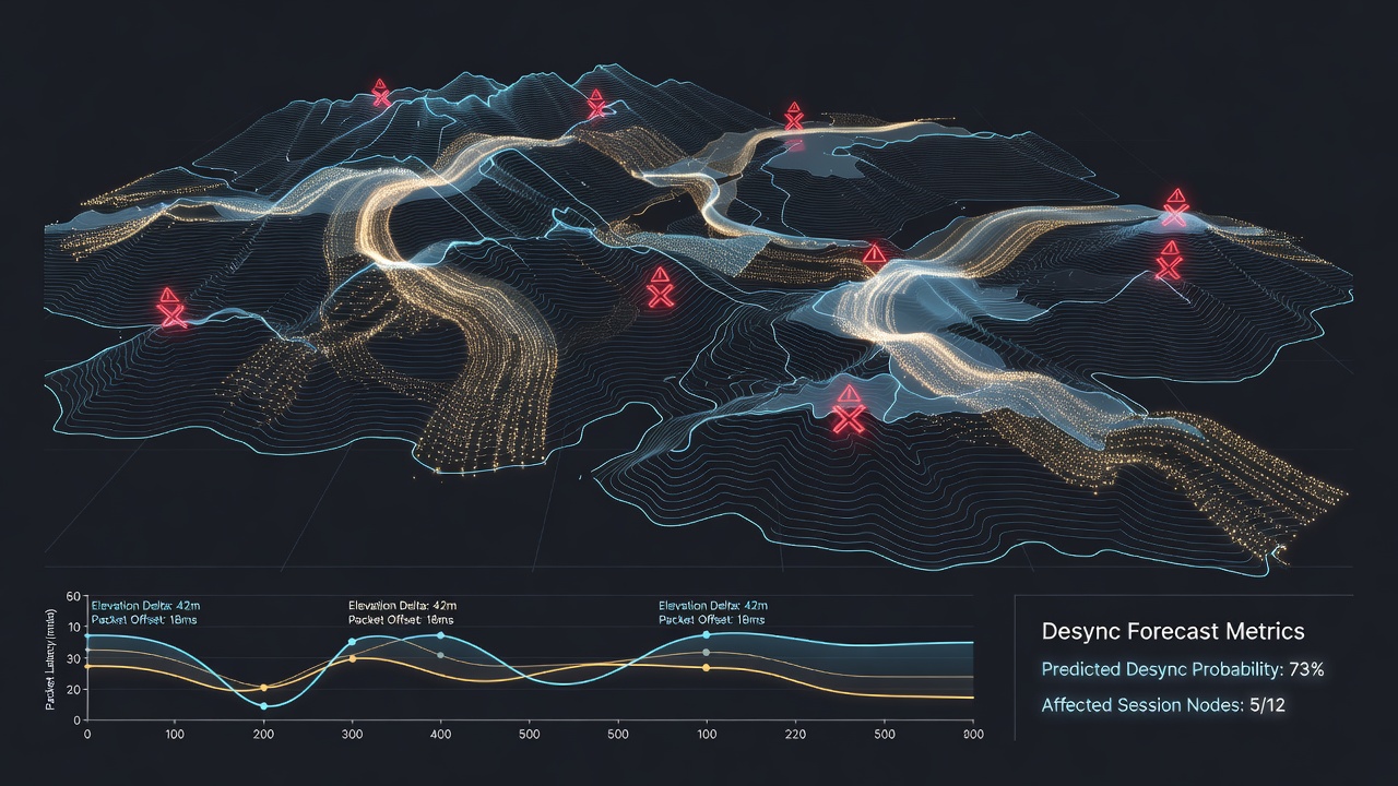
Network engineers and game developers have explored techniques that align sequences of data packets with elevation profiles drawn from virtual terrain models, and these alignments help identify patterns that precede desynchronization in multiplayer environments where multiple clients traverse the same persistent space. Shared-world traversal sessions rely on continuous state synchronization across distributed systems, yet elevation changes in the game world often coincide with shifts in packet timing and loss rates that can trigger desync events when one client renders terrain features differently from others.
Understanding Desync Events in Persistent Worlds
Desync events occur when client and server representations of position, velocity, or environmental geometry diverge beyond acceptable thresholds, and studies of large-scale online titles show that these divergences frequently cluster around steep elevation gradients or rapid height transitions. Researchers have mapped packet arrival intervals against terrain slope data to reveal correlations between packet jitter spikes and areas where elevation exceeds certain thresholds measured in virtual meters. In practice, the ball lands in the developers' court when they must decide how to prioritize terrain mesh updates versus player movement vectors during high-traffic periods.
Packet Sequence Analysis Techniques
Packet sequence analysis begins with timestamped logs collected from client-server exchanges, and analysts then overlay these timestamps onto elevation grids extracted from the game world's heightmap files. Data indicates that sequences containing multiple acknowledgments delayed by more than 50 milliseconds tend to align with terrain sections featuring elevation changes greater than 15 meters over a 10-meter horizontal distance. Observers note that combining these two datasets allows predictive models to flag upcoming desync risks several seconds before visual or positional mismatches become apparent to players.
Integrating Terrain Elevation Data
Terrain elevation data enters the forecasting process through precomputed lookup tables that store slope angles, height differentials, and occlusion values for each world coordinate, while network monitoring tools feed live packet metadata into the same coordinate system. This integration produces heatmaps where color intensity represents the probability of a desync event based on both elevation complexity and recent packet loss statistics. Figures from industry reports reveal that such combined visualizations have been deployed in testing environments for titles released or updated around August 2026, allowing teams to adjust asset streaming priorities in real time.

One study conducted by researchers at a Canadian institution demonstrated that elevation-aware packet scheduling reduced the frequency of desync reports by measurable margins during controlled stress tests involving hundreds of simultaneous traversals across mountainous regions. The approach treats elevation not as static scenery but as an active variable that influences bandwidth allocation and interpolation strategies.
Forecasting Models and Implementation
Forecasting models employ time-series algorithms that treat packet sequence deviations as signals and elevation features as contextual multipliers, and these models output probability scores for desync likelihood within defined spatial zones. According to findings presented at technical conferences, models trained on combined datasets outperform those relying solely on network metrics by capturing edge cases where terrain complexity amplifies minor packet delays into full state mismatches. What's interesting is how the same methodology has been adapted for different regions, with teams referencing guidelines from the Australian Communications and Media Authority when calibrating latency thresholds for titles distributed across Oceania servers.
Case Examples from Development Pipelines
Take one engineering group that integrated elevation packet mapping into their build pipeline for an open-world title and discovered clusters of desync reports precisely where elevation data indicated sharp ridges crossing common player paths. There's this case where experts adjusted client-side prediction buffers based on these maps, resulting in smoother traversal across those ridges without increasing overall bandwidth consumption. Another implementation linked packet retransmission patterns directly to elevation-derived occlusion values, allowing the server to preemptively send additional terrain chunks before clients reached high-risk zones.
Challenges in Data Alignment and Scaling
Challenges arise when aligning packet logs with elevation data because coordinate systems may differ between networking layers and rendering engines, yet developers address these through standardized world-space transforms applied during post-processing. Scaling the technique to larger player counts requires efficient spatial indexing structures that query elevation values only for regions currently occupied by active sessions. Research indicates that memory overhead remains manageable when elevation data is quantized into 8-bit slope categories rather than full floating-point height values.
Conclusion
Mapping network packet sequences against terrain elevation data provides a structured method for anticipating desync events in shared-world traversal sessions, and continued refinement of these techniques supports more stable multiplayer experiences across diverse hardware configurations. Organizations continue to publish updated datasets and tooling resources that allow additional teams to incorporate elevation-aware forecasting into their synchronization pipelines.